2022 Map of Moyers
USGS Topo · Published 2022About this map
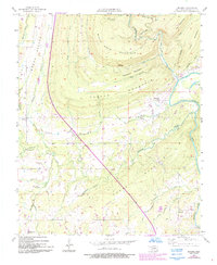
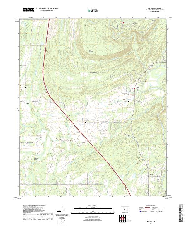
The Impson Valley serves as a prominent geographic corridor through this section of Pushmataha County, where the Kiamichi River winds past the settlement of Moyers. This interior landscape is defined by its ridge-and-valley topography, featuring several significant peaks such as White Rock Mtn, Razorback Mtn, and Parker Mtn. The community of Miller is situated to the west, while Kellond sits near the river's bend in the southeast. Genealogists and local researchers will find value in the documentation of several family-named burial sites, including Miller Cem, Moyers Cem, and Rocky Point Cem. The presence of Tenmile Lake and the nearby Racetrack Prairie suggests a landscape historically utilized for both its water resources and open grazing lands, connected by a network of established county roads like Old Moyers Rd and Miller-Moyer Rd.
Find a feature on this map
80 named features on this map. Tap any name to fly to it.
Don’t see what you’re looking for? This feature index may not catch every label — zoom into the map to look around manually.
Map Details
Editions of this 2022 Moyers Map
This is the sole edition of this map. No revisions or reprints were ever made.