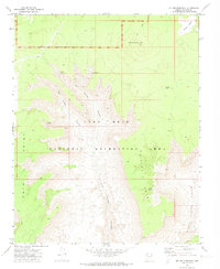
1971 Map of Mt. Dellenbaugh
USGS Topo · Published 1973About this map
Mt Dellenbaugh dominates the high ground in this 1970s survey of the Arizona strip, where the transition from high plateaus to the canyonlands of the Lake Mead National Recreation Area is sharply defined. The terrain is marked by deep incisions like Twin Spring Canyon and Green Spring Canyon, which channel seasonal runoff toward the Colorado River system. This landscape reflects a critical water-management history for western ranching, evidenced by the scattered network of named water sources such as Mathis Spring, Suicide Tank, and Lower Spring. Beyond the natural drainage, the presence of a lone Jeep Trail cutting across the northern reaches illustrates the limited access and land use patterns of this remote Mohave County interior before modern infrastructure reached the rim. Large promontories like Twin Point and Suicide Point provide significant vertical relief, showing the complex geological layering of the region.
Find a feature on this map
16 named features on this map. Tap any name to fly to it.
Don’t see what you’re looking for? This feature index may not catch every label — zoom into the map to look around manually.
Map Details
Editions of this 1971 Mt. Dellenbaugh Map
This is the sole edition of this map. No revisions or reprints were ever made.
Other maps of this area

1886 · Diamond Creek
USGS Topo · 1:250,000

1886 · Mt. Trumbull
USGS Topo · 1:250,000

1892 · Diamond Creek
USGS Topo · 1:250,000

1892 · Mt. Trumbull
USGS Topo · 1:250,000

1948 · Williams
USGS Topo · 1:250,000

1953 · Grand Canyon
USGS Topo · 1:250,000

1954 · Williams
USGS Topo · 1:250,000

1956 · Williams
USGS Topo · 1:250,000

1957 · Grand Canyon
USGS Topo · 1:250,000

1958 · Grand Canyon
USGS Topo · 1:250,000