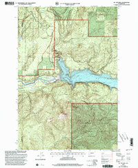
1998 Map of Mt Mitchell
USGS Topo · Published 2003About this map
Swift Reservoir dominates the landscape at the meeting point of Skamania, Cowlitz, and Clark counties, where the Lewis River was harnessed for hydroelectric power. This 1998 revision by the Forest Service highlights a region transitioning into a managed volcanic monument following the 1980 eruption of Mt St Helens. Evidence of the area's complex geology is prominent at the Ape Cave Interpretive Site, featuring the Ape Cave Entrance and Ape Cave Skylight, alongside the Trail of Two Forests Interpretive Trail.
Find a feature on this map
25 named features on this map. Tap any name to fly to it.
Don’t see what you’re looking for? This feature index may not catch every label — zoom into the map to look around manually.
Map Details
Editions of this 1998 Mt Mitchell Map
This is the sole edition of this map. No revisions or reprints were ever made.
Other maps of this area

1919 · Mount St Helens
USGS Topo · 1:125,000

1940 · Lookout Mtn
USGS Topo · 1:62,500

1941 · Yacolt
USGS Topo · 1:62,500

1948 · Vancouver
USGS Topo · 1:250,000

1950 · Vancouver
USGS Topo · 1:250,000

1950 · Vancouver
USGS Topo · 1:250,000

1953 · Hoquiam
USGS Topo · 1:250,000

1953 · Lookout Mtn
USGS Topo · 1:62,500

1953 · Cougar
USGS Topo · 1:62,500
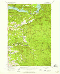
1956 · Yacolt
USGS Topo · 1:62,500