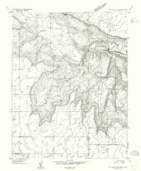
1954 Map of Mt Peale 4 SE
USGS Topo · Published 1955About this map
The Utah-Colorado state line and the border between San Juan and San Miguel counties bisect this high-elevation landscape as it appeared in the mid-1950s. The terrain is dominated by complex canyon systems and plateau formations, including the Lower Lisbon Valley to the northwest and the prominent Horse Range Mesa to the east. Human presence is sparse but concentrated along the few access routes, notably at the West Summit Sch near the southern edge of the survey. This 1954 mapping project captures a network of primitive roads and survey points like Summit Point that helped define this remote corner of the American West before modern infrastructure arrived. The map details natural drainage features such as Bear Trap Canyon, providing a critical look at the water sources and topographical obstacles that dictated local movement and land use during this era.
Find a feature on this map
19 named features on this map. Tap any name to fly to it.
Don’t see what you’re looking for? This feature index may not catch every label — zoom into the map to look around manually.
Map Details
Editions of this 1954 Mt Peale 4 SE Map
This is the sole edition of this map. No revisions or reprints were ever made.
Other maps of this area

1885 · La Sal
USGS Topo · 1:250,000

1886 · Abajo
USGS Topo · 1:250,000

1892 · Abajo
USGS Topo · 1:250,000

1893 · Abajo
USGS Topo · 1:250,000

1916 · Paradox Valley
USGS Topo · 1:125,000

1922 · Paradox Valley
USGS Topo · 1:125,000

1948 · Horse Range Mesa
USGS Topo · 1:24,000

1949 · Egnar
USGS Topo · 1:24,000
1949 · Anderson Mesa
USGS Topo · 1:24,000

1950 · Horse Range Mesa
USGS Topo · 1:24,000