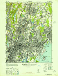
1947 Map of Mt Vernon
USGS Topo · Published 1947About this map
Fort Slocum stands prominently on Davids Island in the Long Island Sound, marking the southeastern marine boundary of this late-1940s Westchester landscape. The area is defined by dense residential growth and a sophisticated network of institutions, including the Jewish Orphanage, Grassy Sprain Hosp, and Sarah Lawrence College. Transportation patterns are shifting as the Pelham Port Washington Ferry route crosses the sound while inland rail hubs like Wykagyl Sta and Quaker Ridge Sta service established neighborhoods.
Find a feature on this map
114 named features on this map. Tap any name to fly to it.
Don’t see what you’re looking for? This feature index may not catch every label — zoom into the map to look around manually.
Map Details
Editions of this 1947 Mt Vernon Map
This is the sole edition of this map. No revisions or reprints were ever made.
Other maps of this area

1891 · Harlem
USGS Topo · 1:62,500

1892 · Stamford
USGS Topo · 1:62,500

1892 · Tarrytown
USGS Topo · 1:62,500

1893 · Stamford
USGS Topo · 1:62,500

1893 · Tarrytown
USGS Topo · 1:62,500

1897 · Harlem
USGS Topo · 1:62,500

1897 · Oyster Bay
USGS Topo · 1:62,500

1898 · Harlem
USGS Topo · 1:62,500

1898 · Oyster Bay
USGS Topo · 1:62,500

1899 · Stamford
USGS Topo · 1:62,500