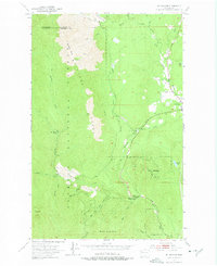
1953 Map of Mt. Walker
USGS Topo · Published 1975About this map
Quilcene sits near the eastern edge of the Olympic National Forest, serving as a central hub where the Big Quilcene River and Little Quilcene River descend from the high ridges. This 1953 survey captures a landscape defined by forestry and conservation infrastructure, including the U S Fish Hatchery and the Rainbow Camp Guard Sta. High-elevation landmarks like Mt Walker, Green Mtn, and Buck Mountain dominate the terrain, while technical details like the Pipe Line and a Diversion Dam on the Big Quilcene show the mid-century management of the region's water resources. Backcountry access is marked by the Bark Shanty Shelter and a network of Pack Trails and the Townsend Creek Trail, offering a detailed view of the Olympic Peninsula's interior before modern expansion.
Find a feature on this map
33 named features on this map. Tap any name to fly to it.
Don’t see what you’re looking for? This feature index may not catch every label — zoom into the map to look around manually.
Map Details
Editions of this 1953 Mt. Walker Map
4 editions found

Other maps of this area

1936 · Point Misery
USGS Topo · 1:62,500

1938 · Mt Constance
USGS Topo · 1:125,000

1940 · Point Misery
USGS Topo · 1:62,500

1940 · Quilcene
USGS Topo · 1:62,500

1946 · Tyler Peak
USGS Topo · 1:62,500

1947 · The Brothers
USGS Topo · 1:62,500

1948 · Tyler Peak
USGS Topo · 1:62,500

1950 · The Brothers
USGS Topo · 1:62,500

1953 · Seabeck
USGS Topo · 1:24,000

1953 · Quilcene
USGS Topo · 1:24,000