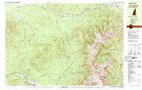
1982 Map of Mt. Washington
USGS Topo · Published 1983About this map
Mt Washington and the surrounding Presidential Range dominate this early 1980s landscape, illustrating a complex network of recreational and industrial infrastructure. The iconic Mount Washington Cog Railway ascends from Base Station and Marshfield Sta toward the summit, where Mt Washington State Park and various Radio Towers are situated. The map provides a detailed view of high-altitude shelters including Madison Hut and Lakes of the Clouds Hut, as well as the historic Appalachian Trail threading through the Great Gulf Wilderness.
Find a feature on this map
124 named features on this map. Tap any name to fly to it.
Don’t see what you’re looking for? This feature index may not catch every label — zoom into the map to look around manually.
Map Details
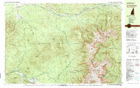
Editions of this 1982 Mt. Washington Map
2 editions found
Other maps of this area

1893 · Mt. Washington
USGS Topo · 1:62,500

1893 · Gorham
USGS Topo · 1:62,500

1894 · North Conway
USGS Topo · 1:62,500

1895 · Crawford Notch
USGS Topo · 1:62,500

1896 · Mt. Washington
USGS Topo · 1:62,500

1896 · Crawford Notch
USGS Topo · 1:62,500

1896 · North Conway
USGS Topo · 1:62,500

1896 · Gorham
USGS Topo · 1:62,500

1900 · Whitefield
USGS Topo · 1:62,500

1929 · Franconia
USGS Topo · 1:62,500