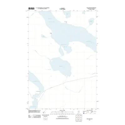
2011 Map of Mud Pond
USGS Topo · Published 2011About this map
Chamberlain Lake and Telos Lake dominate this northern Maine landscape, illustrating a complex network of waterways that have long served the timber industry. The presence of the Umbazooksus Dam at the southern end of Umbazooksus Lake highlights the historical engineering required to manage water levels for log driving. This interior wilderness shows very few signs of permanent habitation, with Chamberlain Farm standing as a solitary settlement on the northern shore of the lake. The terrain is characterized by low-lying wetlands and numerous interconnecting streams such as Mud Brook, Carry Brook, and Dottle Brook. For researchers, the map provides a clear view of the primitive infrastructure of the region, including the solitary transit of North Rd through the woods and landmarks like Donnely Point.
Find a feature on this map
17 named features on this map. Tap any name to fly to it.
Don’t see what you’re looking for? This feature index may not catch every label — zoom into the map to look around manually.
Map Details
Editions of this 2011 Mud Pond Map
This is the sole edition of this map. No revisions or reprints were ever made.
Other maps of this area

1953 · Telos Lake
USGS Topo · 1:62,500

1954 · Chesuncook
USGS Topo · 1:62,500

1954 · Spider Lake
USGS Topo · 1:62,500

1954 · Churchill Lake
USGS Topo · 1:62,500

1954 · Presque Isle
USGS Topo · 1:250,000

1957 · Telos Lake
USGS Topo · 1:62,500

1958 · Presque Isle
USGS Topo · 1:250,000

1958 · Chesuncook
USGS Topo · 1:62,500

1960 · Presque Isle
USGS Topo · 1:250,000

1961 · Spider Lake
USGS Topo · 1:62,500