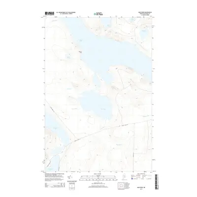
2014 Map of Mud Pond
USGS Topo · Published 2014About this map
Chamberlain Lake dominates this northern Piscataquis County landscape, serving as a central hub for the drainage networks of the Maine woods. The map illustrates a complex hydrologic system where waterways like Mud Brook and Carry Brook connect smaller catchments such as Lost Pond and Mud Pond to larger basins. In the south, the waters of Umbazooksus Lake and the northern reach of Chesuncook Lake underscore the historical importance of these interconnected lakes for regional transport and logging.
Find a feature on this map
17 named features on this map. Tap any name to fly to it.
Don’t see what you’re looking for? This feature index may not catch every label — zoom into the map to look around manually.
Map Details
Editions of this 2014 Mud Pond Map
This is the sole edition of this map. No revisions or reprints were ever made.
Other maps of this area

1953 · Telos Lake
USGS Topo · 1:62,500

1954 · Chesuncook
USGS Topo · 1:62,500

1954 · Spider Lake
USGS Topo · 1:62,500

1954 · Churchill Lake
USGS Topo · 1:62,500

1954 · Presque Isle
USGS Topo · 1:250,000

1957 · Telos Lake
USGS Topo · 1:62,500

1958 · Presque Isle
USGS Topo · 1:250,000

1958 · Chesuncook
USGS Topo · 1:62,500

1960 · Presque Isle
USGS Topo · 1:250,000

1961 · Spider Lake
USGS Topo · 1:62,500