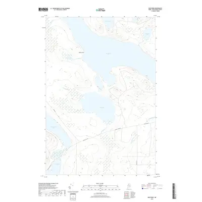
2018 Map of Mud Pond
USGS Topo · Published 2018About this map
Chamberlain Lake dominates the northern reaches of this Piscataquis County landscape, where the waters of the Allagash Wilderness region converge. This 2018 survey illustrates a complex network of glacial ponds and drainages, including the central Mud Pond and the northern tip of Chesuncook Lake. The presence of Carry Brook and Garry Bog suggests a terrain shaped by heavy saturation and seasonal water flow, long utilized by those navigating the legendary canoe routes of the Maine woods. A series of forest management routes, such as Winter Rd and Longley Stream Rd, provide the primary human access through this timberland. At Donnely Point, the shoreline of Chamberlain Lake reaches into the water, marking a distinct landmark for travelers navigating between Indian Pond and the southern lakes. This map serves as a contemporary record of a remote watershed that has remained largely defined by its natural hydrology for over a century.
Find a feature on this map
19 named features on this map. Tap any name to fly to it.
Don’t see what you’re looking for? This feature index may not catch every label — zoom into the map to look around manually.
Map Details
Editions of this 2018 Mud Pond Map
This is the sole edition of this map. No revisions or reprints were ever made.
Other maps of this area

1953 · Telos Lake
USGS Topo · 1:62,500

1954 · Chesuncook
USGS Topo · 1:62,500

1954 · Spider Lake
USGS Topo · 1:62,500

1954 · Churchill Lake
USGS Topo · 1:62,500

1954 · Presque Isle
USGS Topo · 1:250,000

1957 · Telos Lake
USGS Topo · 1:62,500

1958 · Presque Isle
USGS Topo · 1:250,000

1958 · Chesuncook
USGS Topo · 1:62,500

1960 · Presque Isle
USGS Topo · 1:250,000

1961 · Spider Lake
USGS Topo · 1:62,500