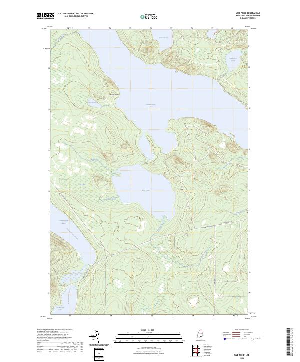
2024 Map of Mud Pond
USGS Topo · Published 2024About this map
The Allagash Wild and Scenic River corridor dominates this remote section of Piscataquis County, anchoring a complex network of glacial lakes and portage streams. Central to this landscape is Chamberlain Lake, which connects with Mud Pond via Carry Brook, tracing a traditional wilderness route. The presence of Donnely Point and the low-lying Carry Bog highlights the delicate balance between land and water in this timber-rich region.
Find a feature on this map
21 named features on this map. Tap any name to fly to it.
Don’t see what you’re looking for? This feature index may not catch every label — zoom into the map to look around manually.
Map Details
Editions of this 2024 Mud Pond Map
This is the sole edition of this map. No revisions or reprints were ever made.
Other maps of this area

1953 · Telos Lake
USGS Topo · 1:62,500

1954 · Chesuncook
USGS Topo · 1:62,500

1954 · Spider Lake
USGS Topo · 1:62,500

1954 · Churchill Lake
USGS Topo · 1:62,500

1954 · Presque Isle
USGS Topo · 1:250,000

1957 · Telos Lake
USGS Topo · 1:62,500

1958 · Presque Isle
USGS Topo · 1:250,000

1958 · Chesuncook
USGS Topo · 1:62,500

1960 · Presque Isle
USGS Topo · 1:250,000

1961 · Spider Lake
USGS Topo · 1:62,500