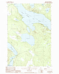
1988 Map of Mud Pond
USGS Topo · Published 1988About this map
Chamberlain Farm stands as a notable human footprint in this remote stretch of the North Maine Woods, situated on the southern shore of Chamberlain Lake. This 1988 provisional map documents a landscape defined by its intricate hydrology and historical transport routes, most notably the Old Railroad Grade that skirts the western edge of Umbazooksus Lake. This corridor, along with the Allagash Wilderness Waterway, highlights the area's transition from an industrial logging landscape to a protected recreational corridor.
Find a feature on this map
35 named features on this map. Tap any name to fly to it.
Don’t see what you’re looking for? This feature index may not catch every label — zoom into the map to look around manually.
Map Details
Editions of this 1988 Mud Pond Map
This is the sole edition of this map. No revisions or reprints were ever made.
Other maps of this area

1953 · Telos Lake
USGS Topo · 1:62,500

1954 · Chesuncook
USGS Topo · 1:62,500

1954 · Spider Lake
USGS Topo · 1:62,500

1954 · Churchill Lake
USGS Topo · 1:62,500

1954 · Presque Isle
USGS Topo · 1:250,000

1957 · Telos Lake
USGS Topo · 1:62,500

1958 · Presque Isle
USGS Topo · 1:250,000

1958 · Chesuncook
USGS Topo · 1:62,500

1960 · Presque Isle
USGS Topo · 1:250,000

1961 · Spider Lake
USGS Topo · 1:62,500