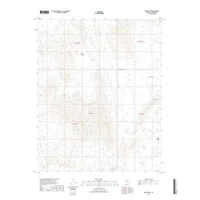
2018 Map of Muddy Peak
USGS Topo · Published 2018About this map
Muddy Peak stands as the high point of this arid landscape, anchoring the Muddy Mountains within the northeastern reach of the Mojave Desert. The map reveals a complex network of dry drainage systems, notably Lovell Wash and Callville Wash, which carve through the fractured geology. The terrain is marked by significant depressions and ridges, including the White Basin and the prominent Bitter Ridge to the east. This survey captures a region defined by its isolation and topographical extremity, where the land drops away into the Bitter Spring Valley. The lack of human infrastructure or named settlements highlights the challenging nature of this Clark County interior, focusing instead on the natural landforms and the township and range lines that grid this corner of the desert.
Find a feature on this map
13 named features on this map. Tap any name to fly to it.
Don’t see what you’re looking for? This feature index may not catch every label — zoom into the map to look around manually.
Map Details
Editions of this 2018 Muddy Peak Map
This is the sole edition of this map. No revisions or reprints were ever made.
Other maps of this area

1886 · Saint Thomas
USGS Topo · 1:250,000

1893 · Saint Thomas
USGS Topo · 1:250,000

1926 · Boulder Canyon
USGS Topo · 1:96,000

1952 · Dry Lake
USGS Topo · 1:62,500

1952 · Henderson
USGS Topo · 1:62,500

1953 · Muddy Peak
USGS Topo · 1:62,500

1953 · Hoover Dam
USGS Topo · 1:62,500

1954 · Las Vegas
USGS Topo · 1:250,000

1957 · Las Vegas
USGS Topo · 1:250,000

1959 · Las Vegas
USGS Topo · 1:250,000