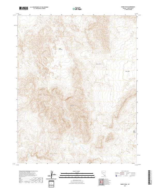
2021 Map of Muddy Peak
USGS Topo · Published 2021About this map
Muddy Peak rises as the central landmark in this portion of the Muddy Mountains, where the drainage patterns of the Mojave Desert are clearly etched. The map reveals a network of seasonal watercourses, most notably Lovell Wash and Callville Wash, which carve through the high terrain to define the local topography. This area, largely defined by the arid basins and ridges of Southern Nevada, includes the distinct geological depressions of White Basin and Bitter Spring Valley. To the south, the Gale Hills provide a transition in the landscape, while Bitter Ridge forms a prominent eastern spine. The absence of modern development on this 2021 sheet highlights the persistence of the natural environment, specifically emphasizing the relief between the peaks and the surrounding washes like W End Wash.
Find a feature on this map
14 named features on this map. Tap any name to fly to it.
Don’t see what you’re looking for? This feature index may not catch every label — zoom into the map to look around manually.
Map Details
Editions of this 2021 Muddy Peak Map
This is the sole edition of this map. No revisions or reprints were ever made.
Other maps of this area

1886 · Saint Thomas
USGS Topo · 1:250,000

1893 · Saint Thomas
USGS Topo · 1:250,000

1926 · Boulder Canyon
USGS Topo · 1:96,000

1952 · Dry Lake
USGS Topo · 1:62,500

1952 · Henderson
USGS Topo · 1:62,500

1953 · Muddy Peak
USGS Topo · 1:62,500

1953 · Hoover Dam
USGS Topo · 1:62,500

1954 · Las Vegas
USGS Topo · 1:250,000

1957 · Las Vegas
USGS Topo · 1:250,000

1959 · Las Vegas
USGS Topo · 1:250,000