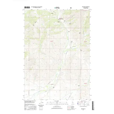
2017 Map of Muldoon
USGS Topo · Published 2017About this map
Muldoon and Rocky Bar sit within a landscape of steep canyons and high ridges at the edge of the Sawtooth National Forest in central Idaho. The terrain is defined by the drainage of Muldoon Cr, which flows southward through a deep valley bordered by prominent features like Smelter Butte and Muldoon Ridge. To the north, the elevation rises toward Garfield Mtn and the sheer face of Bell Rock. This 2017 survey reflects the persistent influence of the region's mining and grazing history, evidenced by the presence of Logan Tunnel and a network of specialized access routes like the Flat Top Sheep Rd and Muldoon Canyon Rd. These roads wind through significant gulches, including Boundary Gulch and Morman Gulch, following the natural topography created by numerous tributaries such as Chicken Cr and Thompson Cr.
Find a feature on this map
41 named features on this map. Tap any name to fly to it.
Don’t see what you’re looking for? This feature index may not catch every label — zoom into the map to look around manually.
Map Details
Editions of this 2017 Muldoon Map
This is the sole edition of this map. No revisions or reprints were ever made.
Other maps of this area

1895 · Hailey
USGS Topo · 1:125,000

1897 · Hailey
USGS Topo · 1:125,000

1935 · MacKay
USGS Topo · 1:96,000

1955 · Idaho Falls
USGS Topo · 1:250,000

1955 · Hailey
USGS Topo · 1:250,000

1958 · Idaho Falls
USGS Topo · 1:250,000

1959 · Hailey
USGS Topo · 1:250,000

1960 · Muldoon Canyon
USGS Topo · 1:62,500

1962 · Hailey
USGS Topo · 1:250,000

1967 · Baugh Creek
USGS Topo · 1:24,000