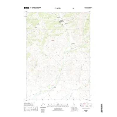
2020 Map of Muldoon
USGS Topo · Published 2020About this map
Sawtooth National Forest encompasses the northern reaches of this Idaho landscape, where the high-elevation terrain is defined by prominent peaks like Garfield Mtn and Elk Mtn. The drainage system of Muldoon Cr and its tributaries, such as Little Thompson Cr and Chicken Cr, carves a series of deep gulches and canyons through the region. Evidence of historical mining activity is anchored by the Logan Tunnel in the northeast, while the lower elevations near Rocky Bar transition into more accessible terrain marked by rural routes like Muldoon Canyon Rd and Flat Top Sheep Rd. This area reflects a classic Idaho pattern of high-country timber and grazing lands, with landmarks such as Smelter Butte and Muldoon Ridge serving as primary navigational points for those moving through the rugged interior of Blaine County.
Find a feature on this map
37 named features on this map. Tap any name to fly to it.
Don’t see what you’re looking for? This feature index may not catch every label — zoom into the map to look around manually.
Map Details
Editions of this 2020 Muldoon Map
This is the sole edition of this map. No revisions or reprints were ever made.
Other maps of this area

1895 · Hailey
USGS Topo · 1:125,000

1897 · Hailey
USGS Topo · 1:125,000

1935 · MacKay
USGS Topo · 1:96,000

1955 · Idaho Falls
USGS Topo · 1:250,000

1955 · Hailey
USGS Topo · 1:250,000

1958 · Idaho Falls
USGS Topo · 1:250,000

1959 · Hailey
USGS Topo · 1:250,000

1960 · Muldoon Canyon
USGS Topo · 1:62,500

1962 · Hailey
USGS Topo · 1:250,000

1967 · Baugh Creek
USGS Topo · 1:24,000