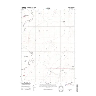
2013 Map of Mule Butte
USGS Topo · Published 2013About this map
Craters of the Moon National Preserve dominates the western edge of this Idaho landscape, illustrating the stark boundary between volcanic fields and the high desert plains. In the eastern portion of the map, the Great Rift marks a significant geologic fracture, a prominent fissure system that shaped the region’s unique volcanic topography. The survey provides critical detail for researchers tracing subterranean structures, most notably the Bear Trap Lava Tube in the southeastern corner. This volcanic feature, alongside landmarks like Mule Butte, indicates a complex network of ancient lava flows and vents. The land is largely defined by these geological formations, with no major settlements or permanent structures recorded, focusing instead on the scientific and environmental value of this protected Idaho wilderness.
Find a feature on this map
10 named features on this map. Tap any name to fly to it.
Don’t see what you’re looking for? This feature index may not catch every label — zoom into the map to look around manually.
Map Details
Editions of this 2013 Mule Butte Map
This is the sole edition of this map. No revisions or reprints were ever made.
Other maps of this area

1954 · Pocatello
USGS Topo · 1:250,000

1955 · Idaho Falls
USGS Topo · 1:250,000

1958 · Idaho Falls
USGS Topo · 1:250,000

1958 · Pocatello
USGS Topo · 1:250,000

1972 · Antelope Lake
USGS Topo · 1:24,000

1972 · Bear Trap Cave
USGS Topo · 1:24,000

1972 · Mule Butte
USGS Topo · 1:24,000

1972 · Bear Park SW
USGS Topo · 1:24,000

1972 · Mosby Butte
USGS Topo · 1:24,000

1972 · Bear Park East
USGS Topo · 1:24,000