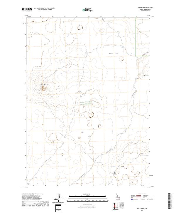
2023 Map of Mule Butte
USGS Topo · Published 2023About this map
Craters of the Moon National Preserve occupies much of this landscape, illustrating a complex volcanic environment in Blaine County. The terrain is characterized by geological landmarks such as Mule Butte and the vast Great Rift, which cuts across the central portion of the sheet. Historically, the area is defined by its transit challenges, represented here by the long stretch of the Minidoka to Arco Rd as it navigates through the lava fields. A notable subterranean feature, the Bear Trap Lava Tube, is marked in the southern section, indicating the unique volcanic plumbing of this high-desert region. The absence of settlements or established water sources underscores the demanding nature of the topography and its primary use for conservation and regional transit.
Find a feature on this map
11 named features on this map. Tap any name to fly to it.
Don’t see what you’re looking for? This feature index may not catch every label — zoom into the map to look around manually.
Map Details
Editions of this 2023 Mule Butte Map
This is the sole edition of this map. No revisions or reprints were ever made.
Other maps of this area

1954 · Pocatello
USGS Topo · 1:250,000

1955 · Idaho Falls
USGS Topo · 1:250,000

1958 · Idaho Falls
USGS Topo · 1:250,000

1958 · Pocatello
USGS Topo · 1:250,000

1972 · Antelope Lake
USGS Topo · 1:24,000

1972 · Bear Trap Cave
USGS Topo · 1:24,000

1972 · Mule Butte
USGS Topo · 1:24,000

1972 · Bear Park SW
USGS Topo · 1:24,000

1972 · Mosby Butte
USGS Topo · 1:24,000

1972 · Bear Park East
USGS Topo · 1:24,000