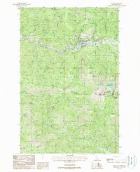
1988 Map of Mullan
USGS Topo · Published 1988About this map
Mullan sits at the heart of the Coeur d'Alene mining district, framed by the industrial legacy of the Silver Valley. This late-twentieth-century study documents a landscape defined by heavy extraction, with the Lucky Friday Mine and several levels of the Morning Mine 4 and Morning Mine 3 flanking the South Fork Coeur d'Alene River. The proximity of a Trailer Park and an Old RR Grade to these active and historic mine sites illustrates the tight relationship between the local workforce and the geology of the Bitterroot Mountains.
Find a feature on this map
55 named features on this map. Tap any name to fly to it.
Don’t see what you’re looking for? This feature index may not catch every label — zoom into the map to look around manually.
Map Details
Editions of this 1988 Mullan Map
This is the sole edition of this map. No revisions or reprints were ever made.
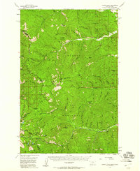
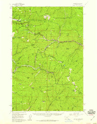
Other maps of this area

1901 · Coeur D'Alene District
USGS Topo · 1:62,500

1903 · Coeur D'Alene District
USGS Topo · 1:62,500

1906 · Coeur D'Alene District
USGS Topo · 1:62,500

1914 · Avery
USGS Topo · 1:125,000

1917 · Avery
USGS Topo · 1:125,000

1932 · Trout Creek
USGS Topo · 1:125,000

1935 · Trout Creek
USGS Topo · 1:125,000

1936 · Trout Creek
USGS Topo · 1:125,000
1956 · Cooper Gulch
USGS Topo · 1:62,500
1956 · Saltese
USGS Topo · 1:62,500