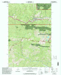
1995 Map of Mullan
USGS Topo · Published 1998About this map
Mullan sits at the heart of a high-country mining district, dominated by the valley of the South Fork Coeur d'Alene River. This 1990s survey, updated from earlier field checks, illustrates the intensive industrial footprint of the Silver Valley, where major operations like the Lucky Friday Mine and the Star Mine are positioned along the steep canyon walls. The town's layout is closely bound by the surrounding peaks, with local Cems and residential areas tucked between the river and the rising slopes of the Coeur d'Alene National Forest.
Find a feature on this map
52 named features on this map. Tap any name to fly to it.
Don’t see what you’re looking for? This feature index may not catch every label — zoom into the map to look around manually.
Map Details
Editions of this 1995 Mullan Map
This is the sole edition of this map. No revisions or reprints were ever made.
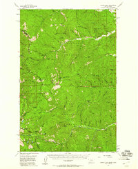
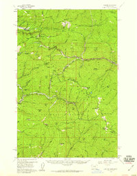
Other maps of this area

1901 · Coeur D'Alene District
USGS Topo · 1:62,500

1903 · Coeur D'Alene District
USGS Topo · 1:62,500

1906 · Coeur D'Alene District
USGS Topo · 1:62,500

1914 · Avery
USGS Topo · 1:125,000

1917 · Avery
USGS Topo · 1:125,000

1932 · Trout Creek
USGS Topo · 1:125,000

1935 · Trout Creek
USGS Topo · 1:125,000

1936 · Trout Creek
USGS Topo · 1:125,000
1956 · Cooper Gulch
USGS Topo · 1:62,500
1956 · Saltese
USGS Topo · 1:62,500