
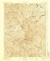
1912 Map of Mullens
USGS Topo · Published 1912About this map
Guyandot Mountain and a series of high ridges define this 1910 survey of the rugged coal country where Raleigh and Wyoming counties meet. The industrial heart of the region is traced by the Virginian RR, which winds through narrow valleys to serve settlements like Mullens, Slab Fork, and Stotesbury. The landscape is etched with steep terrain features such as Winding Gulf Ridge and Horsepen Ridge, dictating the placement of early infrastructure. Smaller community hubs like Tams Gulf P.O and Lester appear alongside numerous creeks and branches, providing a clear view of the early 20th-century mining and rail network. Local landmarks including Jenny Gap and Skinned Poplar Gap offer critical navigation points through the dense topography of the Slab Fork District.
Find a feature on this map
130 named features on this map. Tap any name to fly to it.
Don’t see what you’re looking for? This feature index may not catch every label — zoom into the map to look around manually.
Map Details
Editions of this 1912 Mullens Map
2 editions found
Other maps of this area

1887 · Pocahontas
USGS Topo · 1:125,000

1891 · Tazewell
USGS Topo · 1:125,000

1891 · Pocahontas
USGS Topo · 1:125,000

1891 · Oceana
USGS Topo · 1:125,000

1891 · Raleigh
USGS Topo · 1:125,000

1893 · Oceana
USGS Topo · 1:125,000

1894 · Pocahontas
USGS Topo · 1:125,000

1895 · Tazewell
USGS Topo · 1:125,000

1895 · Pocahontas
USGS Topo · 1:125,000

1897 · Tazewell
USGS Topo · 1:125,000