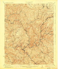
1927 Map of Mullens
USGS Topo · Published 1927About this map
The Virginian railroad winds through the deep valleys of Wyoming and Raleigh counties in this 1927 edition, following the course of the Guyandot River and its major tributaries. This area represents the heart of the southern West Virginia coalfields during their industrial peak, with numerous company towns and settlements tightly packed along the watercourses. The map documents a complex network of rail spurs serving coal camps such as Tams, Stotesbury, McAlpin, and Helen.
Find a feature on this map
88 named features on this map. Tap any name to fly to it.
Don’t see what you’re looking for? This feature index may not catch every label — zoom into the map to look around manually.
Map Details
Editions of this 1927 Mullens Map
2 editions found
Other maps of this area

1887 · Pocahontas
USGS Topo · 1:125,000

1891 · Tazewell
USGS Topo · 1:125,000

1891 · Pocahontas
USGS Topo · 1:125,000

1891 · Oceana
USGS Topo · 1:125,000

1891 · Raleigh
USGS Topo · 1:125,000

1893 · Oceana
USGS Topo · 1:125,000

1894 · Pocahontas
USGS Topo · 1:125,000

1895 · Tazewell
USGS Topo · 1:125,000

1895 · Pocahontas
USGS Topo · 1:125,000

1897 · Tazewell
USGS Topo · 1:125,000