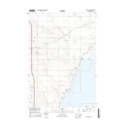
2014 Map of Mullett Lake
USGS Topo · Published 2014About this map
Mullett Lake dominates the eastern edge of this northern Michigan landscape, where the shoreline is punctuated by points like Dodge Point and Veery Point. The inland terrain is defined by a high concentration of heritage sites, particularly cemeteries that reflect the area's diverse cultural history. From the Saint John's German Lutheran Cem and Polish Cem to the African American Cem near the Pbeaye Airport, these landmarks serve as vital points for genealogical research. Small lakefront communities such as Silver Beach and Miami Beach line the western shore, while the interior settlement of Riggsville sits at a crossroads of rural routes. Multiple watercourses including Mullett Cr, Laperell Cr, and Terry Cr drain the higher elevations, carving out features like Tannery Gully and Maxwell Gully as they flow toward the lake.
Find a feature on this map
75 named features on this map. Tap any name to fly to it.
Don’t see what you’re looking for? This feature index may not catch every label — zoom into the map to look around manually.
Map Details
Editions of this 2014 Mullett Lake Map
This is the sole edition of this map. No revisions or reprints were ever made.
Other maps of this area

1955 · Cheboygan
USGS Topo · 1:250,000

1957 · Tower
USGS Topo · 1:62,500

1957 · Wolverine
USGS Topo · 1:62,500

1957 · Cheboygan
USGS Topo · 1:62,500

1957 · Mullett Lake
USGS Topo · 1:62,500

1958 · Cheboygan
USGS Topo · 1:250,000

1982 · Petoskey
USGS Topo · 1:100,000

1982 · Cheboygan
USGS Topo · 1:25,000

1982 · Point Nipigon
USGS Topo · 1:25,000

1982 · Aloha
USGS Topo · 1:25,000