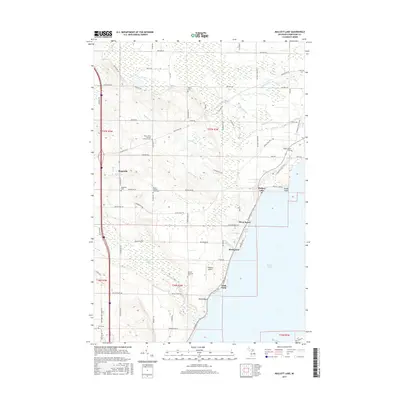
2017 Map of Mullett Lake
USGS Topo · Published 2017About this map
Mullett Lake dominates the eastern half of this northern Michigan landscape, where vacation communities and historical burial grounds share the shoreline and surrounding hills. The map highlights a significant genealogical footprint with numerous small cemeteries, including the Saint John's German Lutheran Cem, Mount Calvary Polish Cem, and a specifically noted African-American Cem near the Pbeaaye Airport. The western interior is defined by a grid of rural roads like Polish Line Rd and Riggsville Rd, connecting the settlement of Riggsville to the lakefront. Along the coast, established seasonal and year-round enclaves such as Miami Beach, Birchwood, and Silver Beach are linked by the N Central State Trail, which follows the path of a former transportation corridor. Drainage from the hills feeds the lake through numerous small waterways like Mullett Cr and Terry Cr, illustrating the area's complex hydrology.
Find a feature on this map
76 named features on this map. Tap any name to fly to it.
Don’t see what you’re looking for? This feature index may not catch every label — zoom into the map to look around manually.
Map Details
Editions of this 2017 Mullett Lake Map
This is the sole edition of this map. No revisions or reprints were ever made.
Other maps of this area

1955 · Cheboygan
USGS Topo · 1:250,000

1957 · Tower
USGS Topo · 1:62,500

1957 · Wolverine
USGS Topo · 1:62,500

1957 · Cheboygan
USGS Topo · 1:62,500

1957 · Mullett Lake
USGS Topo · 1:62,500

1958 · Cheboygan
USGS Topo · 1:250,000

1982 · Petoskey
USGS Topo · 1:100,000

1982 · Cheboygan
USGS Topo · 1:25,000

1982 · Point Nipigon
USGS Topo · 1:25,000

1982 · Aloha
USGS Topo · 1:25,000