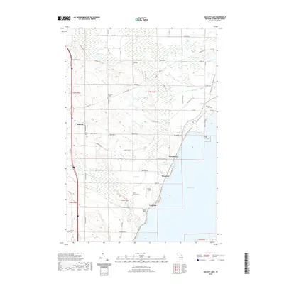
2019 Map of Mullett Lake
USGS Topo · Published 2019About this map
Mullett Lake dominates the eastern half of this northern Michigan landscape, where a series of small lakeside communities including Birchwood, Silver Beach, and Miami Beach line the western shore. The interior of Cheboygan County reveals a history of immigrant and community heritage, centered around the settlement of Riggsville and a high density of rural burial grounds. Genealogists will find a concentration of denominational and ethnic sites such as the Saint John's German Lutheran Cem, Mount Calvary Polish Cem, and an African-American Cem located south of Rbeaye Airport. The transition from old transport routes to recreational use is visible along the N Central State Trail, which traces the shoreline past Long Point and Dodge Point. Several small waterways, including Mullett Creek, Terry Cr, and Lapegell Cr, drain the varied terrain of Mullett Township toward the expansive lake basin.
Find a feature on this map
83 named features on this map. Tap any name to fly to it.
Don’t see what you’re looking for? This feature index may not catch every label — zoom into the map to look around manually.
Map Details
Editions of this 2019 Mullett Lake Map
This is the sole edition of this map. No revisions or reprints were ever made.
Other maps of this area

1955 · Cheboygan
USGS Topo · 1:250,000

1957 · Tower
USGS Topo · 1:62,500

1957 · Wolverine
USGS Topo · 1:62,500

1957 · Cheboygan
USGS Topo · 1:62,500

1957 · Mullett Lake
USGS Topo · 1:62,500

1958 · Cheboygan
USGS Topo · 1:250,000

1982 · Petoskey
USGS Topo · 1:100,000

1982 · Cheboygan
USGS Topo · 1:25,000

1982 · Point Nipigon
USGS Topo · 1:25,000

1982 · Aloha
USGS Topo · 1:25,000