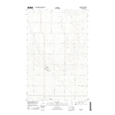
2014 Map of Munich
USGS Topo · Published 2014About this map
Munich sits at the junction of ND-20 and Pacific Ave, serving as a primary settlement hub in this Cavalier County landscape. The town's grid is anchored by Main St and Griffin St, while the surrounding prairie is dotted with অসংখ্য seasonal wetlands and depressions characteristic of the region's topography. The map reveals a deeply rooted community history through several rural burial grounds, including Zion Cem, E Salem Cem, and S Salem Cem, which are spaced across the section lines. To the south, the village of Alsen marks another point of settlement near the intersection of 87th Ave NE and 85th St NE. The natural drainage of the area is defined by Starkweather Coulee, which winds through the southern fields near the junction of ND-66.
Find a feature on this map
25 named features on this map. Tap any name to fly to it.
Don’t see what you’re looking for? This feature index may not catch every label — zoom into the map to look around manually.
Map Details
Editions of this 2014 Munich Map
This is the sole edition of this map. No revisions or reprints were ever made.
Other maps of this area

1953 · Devils Lake
USGS Topo · 1:250,000

1956 · Devils Lake
USGS Topo · 1:250,000

1970 · Alsen
USGS Topo · 1:24,000

1970 · Calvin
USGS Topo · 1:24,000

1970 · Sarles SE
USGS Topo · 1:24,000

1970 · Hannah SW
USGS Topo · 1:24,000

1970 · Hampden
USGS Topo · 1:24,000

1970 · Munich
USGS Topo · 1:24,000

1971 · Calio
USGS Topo · 1:24,000

1971 · Munich SW
USGS Topo · 1:24,000