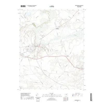
2019 Map of Murfreesboro
USGS Topo · Published 2019About this map
The Meherrin River defines the landscape north of Murfreesboro, winding through a river valley that historically served as a boundary between Northampton and Hertford counties. This late-2010s survey illustrates a region where small agricultural hamlets like Como and Mapleton are connected by a network of rural roads, many of which still carry local family names such as Will Stephenson Rd and Stanley Barnes Rd. In the town of Murfreesboro itself, the presence of the College suggests the area's long-standing role as an educational and cultural center for the surrounding farmland.
Find a feature on this map
95 named features on this map. Tap any name to fly to it.
Don’t see what you’re looking for? This feature index may not catch every label — zoom into the map to look around manually.
Map Details
Editions of this 2019 Murfreesboro Map
This is the sole edition of this map. No revisions or reprints were ever made.
Other maps of this area

1908 · Winton
USGS Topo · 1:62,500

1919 · Boykins
USGS Topo · 1:48,000

1920 · Holland
USGS Topo · 1:62,500

1920 · Boykins
USGS Topo · 1:62,500

1943 · Holland
USGS Topo · 1:62,500

1953 · Norfolk
USGS Topo · 1:250,000

1957 · Holland
USGS Topo · 1:62,500

1966 · Sunbeam
USGS Topo · 1:24,000
1966 · Boykins
USGS Topo · 1:24,000
1967 · Riverdale
USGS Topo · 1:24,000