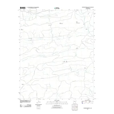
2011 Map of Murfreesboro NE
USGS Topo · Published 2011About this map
Macedonia Cemetery and Hannon Cemetery anchor the southern and northern reaches of this rural Arkansas landscape, which is defined by the complex drainage systems feeding the Antoine River. The topography is marked by significant rises such as Lassie Gap Mountain and Kirby Mountain, which dictate the winding paths of rural routes like Old Hot Spring Rd. Evidence of early settlement is preserved in numerous family-named burial grounds including Woodall Cemetery and Sparks Cemetery. The map reveals a transition from the highlands near Lassie Gap to the lower creek bottoms of South Fork Woodall Creek and Caney Creek. This 2011 edition provides a detailed view of the terrain before more modern development altered the traditional rural character of the area.
Find a feature on this map
72 named features on this map. Tap any name to fly to it.
Don’t see what you’re looking for? This feature index may not catch every label — zoom into the map to look around manually.
Map Details
Editions of this 2011 Murfreesboro NE Map
This is the sole edition of this map. No revisions or reprints were ever made.
Other maps of this area

1906 · Caddo Gap
USGS Topo · 1:125,000

1936 · Glenwood
USGS Topo · 1:48,000

1942 · Glenwood
USGS Topo · 1:62,500

1943 · Antoine
USGS Topo · 1:62,500

1949 · Glenwood
USGS Topo · 1:62,500

1955 · Little Rock
USGS Topo · 1:250,000

1956 · Little Rock
USGS Topo · 1:250,000

1960 · Little Rock
USGS Topo · 1:250,000

1964 · Little Rock
USGS Topo · 1:250,000
1966 · Amity
USGS Topo · 1:24,000