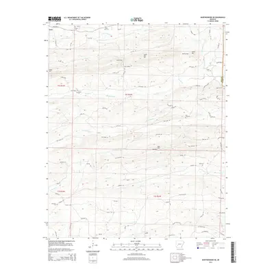
2014 Map of Murfreesboro NE
USGS Topo · Published 2014About this map
Kirby Mtn and Lassie Gap Mtn anchor the high ground in this 2014 survey of the Ouachita foothills along the border of Pike and Clark counties. The landscape is defined by a dense network of timber and access roads, including Tin Can Rd, Ashley Loop, and Shawmut Rd, which wind through the ridges and valleys carved by the Antoine River and its tributaries.
Find a feature on this map
80 named features on this map. Tap any name to fly to it.
Don’t see what you’re looking for? This feature index may not catch every label — zoom into the map to look around manually.
Map Details
Editions of this 2014 Murfreesboro NE Map
This is the sole edition of this map. No revisions or reprints were ever made.
Other maps of this area

1906 · Caddo Gap
USGS Topo · 1:125,000

1936 · Glenwood
USGS Topo · 1:48,000

1942 · Glenwood
USGS Topo · 1:62,500

1943 · Antoine
USGS Topo · 1:62,500

1949 · Glenwood
USGS Topo · 1:62,500

1955 · Little Rock
USGS Topo · 1:250,000

1956 · Little Rock
USGS Topo · 1:250,000

1960 · Little Rock
USGS Topo · 1:250,000

1964 · Little Rock
USGS Topo · 1:250,000
1966 · Amity
USGS Topo · 1:24,000