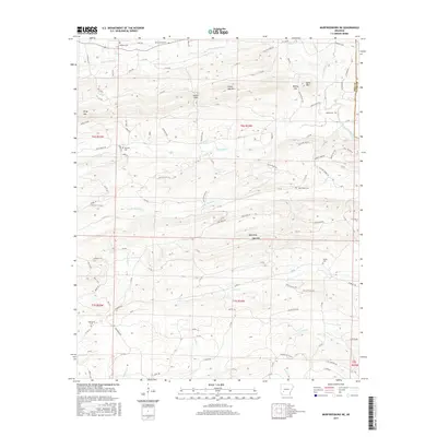
2017 Map of Murfreesboro NE
USGS Topo · Published 2017About this map
The Antoine River carves a path through the eastern boundary of this Arkansas landscape, where the borders of Pike and Clark counties meet. This terrain is defined by a series of prominent ridges and low peaks, including Kirby Mtn, Lassie Gap Mtn, and the distinctive Wall Rock. These elevations dictate the flow of numerous local waterways such as Little Antoine Cr and Prairie Cr, which drain the varied topography of the Ouachita foothills.
Find a feature on this map
122 named features on this map. Tap any name to fly to it.
Don’t see what you’re looking for? This feature index may not catch every label — zoom into the map to look around manually.
Map Details
Editions of this 2017 Murfreesboro NE Map
This is the sole edition of this map. No revisions or reprints were ever made.
Other maps of this area

1906 · Caddo Gap
USGS Topo · 1:125,000

1936 · Glenwood
USGS Topo · 1:48,000

1942 · Glenwood
USGS Topo · 1:62,500

1943 · Antoine
USGS Topo · 1:62,500

1949 · Glenwood
USGS Topo · 1:62,500

1955 · Little Rock
USGS Topo · 1:250,000

1956 · Little Rock
USGS Topo · 1:250,000

1960 · Little Rock
USGS Topo · 1:250,000

1964 · Little Rock
USGS Topo · 1:250,000
1966 · Amity
USGS Topo · 1:24,000