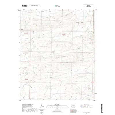
2020 Map of Murfreesboro NE
USGS Topo · Published 2020About this map
The Antoine River winds along the eastern boundary of this Arkansas landscape, carving a border between Pike and Clark counties. This 2020 survey documents a terrain defined by significant ridgelines and summits, including Kirby Mtn in the northwest and the prominent Wall Rock and Wall Mtn complex to the south. Numerous small family or community burial grounds are scattered throughout these hills, such as Macedonia Cem and Woodall Cem, providing critical touchpoints for genealogical research in this rural region.
Find a feature on this map
120 named features on this map. Tap any name to fly to it.
Don’t see what you’re looking for? This feature index may not catch every label — zoom into the map to look around manually.
Map Details
Editions of this 2020 Murfreesboro NE Map
This is the sole edition of this map. No revisions or reprints were ever made.
Other maps of this area

1906 · Caddo Gap
USGS Topo · 1:125,000

1936 · Glenwood
USGS Topo · 1:48,000

1942 · Glenwood
USGS Topo · 1:62,500

1943 · Antoine
USGS Topo · 1:62,500

1949 · Glenwood
USGS Topo · 1:62,500

1955 · Little Rock
USGS Topo · 1:250,000

1956 · Little Rock
USGS Topo · 1:250,000

1960 · Little Rock
USGS Topo · 1:250,000

1964 · Little Rock
USGS Topo · 1:250,000
1966 · Amity
USGS Topo · 1:24,000