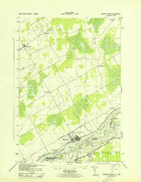
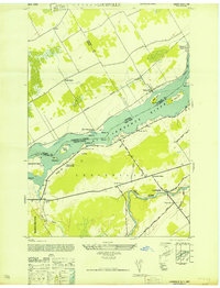
1943 Map of Murphy Island
USGS Topo · Published 1943About this map
St. Lawrence River dominates this 1943 survey, marking the international boundary between the United States and Canada. Along the northern shore in Ontario, the town of Morrisburg serves as a focal point near the Rapide Plat Canal, a vital piece of inland maritime infrastructure before the mid-century seaway expansions. The landscape is a mix of agricultural clearings and dense brush, with small settlements like Williamsburg and Froatsburn connected by a network of rural roads and the Canadian National railway line. South of the river in Waddington, New York, the terrain is defined by low-lying islands and wetlands, including the large Ogden Island and the smaller Murphy Island. Local landmarks such as School No 7 and the Golf Course near Morrisburg highlight the social and recreational footprint of these riverfront communities during the early 1940s.
Find a feature on this map
28 named features on this map. Tap any name to fly to it.
Don’t see what you’re looking for? This feature index may not catch every label — zoom into the map to look around manually.
Map Details
Editions of this 1943 Murphy Island Map
This is the sole edition of this map. No revisions or reprints were ever made.
Other maps of this area

1904 · Lisbon
USGS Topo · 1:48,000

1905 · Waddington
USGS Topo · 1:62,500

1906 · Red Mills
USGS Topo · 1:62,500

1942 · Waddington
USGS Topo · 1:24,000

1942 · Chase Mills
USGS Topo · 1:24,000

1942 · Murphy Island
USGS Topo · 1:24,000
1943 · Waddington
USGS Topo · 1:31,680
1943 · Sparrowhawk Point
USGS Topo · 1:31,680
1943 · Chase Mills
USGS Topo · 1:31,680
1946 · Louisville
USGS Topo · 1:24,000