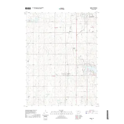
2017 Map of Murray
USGS Topo · Published 2017About this map
The village of Murray and the southern reaches of Plattsmouth anchor this 2017 survey of Cass County, Nebraska. The landscape is defined by the rolling drainage basins of Eightmile Creek, Fourmile Creek, and Ervine Creek, which flow toward the residential developments surrounding Beaver Lake. Significant local history is preserved in the area's rural cemeteries, including Otterbein Cemetery in the southwest and Pleasant Ridge Cemetery to the northeast. Transportation and utility are represented by a network of sectional roads like Rock Bluff Road and the Plattsmouth Municipal Airport. The map also reveals the presence of several private aviation sites and water management features such as Schlichtemeier Reservoir Number 1 and Topliff Reservoir, reflecting the agricultural and residential blend of this Missouri River upland region.
Find a feature on this map
56 named features on this map. Tap any name to fly to it.
Don’t see what you’re looking for? This feature index may not catch every label — zoom into the map to look around manually.
Map Details
Editions of this 2017 Murray Map
This is the sole edition of this map. No revisions or reprints were ever made.
Other maps of this area

1893 · Fremont
USGS Topo · 1:125,000

1896 · Fremont
USGS Topo · 1:125,000

1903 · Weeping Water
USGS Topo · 1:125,000

1929 · Weeping Water
USGS Topo · 1:125,000

1935 · Nehawka
USGS Topo · 1:48,000

1940 · Nehawka
USGS Topo · 1:62,500

1954 · Omaha
USGS Topo · 1:250,000

1955 · Fremont
USGS Topo · 1:250,000

1955 · Nebraska City
USGS Topo · 1:250,000

1955 · Lincoln
USGS Topo · 1:250,000