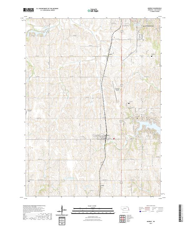
2021 Map of Murray
USGS Topo · Published 2021About this map
Murray serves as a central hub for this Cass County landscape, surrounded by an intricate network of creeks and small reservoirs that define the local drainage patterns. To the north, the southern edge of Plattsmouth and the settlement of Mynard are clearly marked, while the village of Todd sits to the south along Ervine Creek. The topography is shaped by the winding paths of Eightmile Creek, Fourmile Creek, and Tyson Creek, which carve through the agricultural sections of the Nebraska plains.
Find a feature on this map
64 named features on this map. Tap any name to fly to it.
Don’t see what you’re looking for? This feature index may not catch every label — zoom into the map to look around manually.
Map Details
Editions of this 2021 Murray Map
This is the sole edition of this map. No revisions or reprints were ever made.
Other maps of this area

1893 · Fremont
USGS Topo · 1:125,000

1896 · Fremont
USGS Topo · 1:125,000

1903 · Weeping Water
USGS Topo · 1:125,000

1929 · Weeping Water
USGS Topo · 1:125,000

1935 · Nehawka
USGS Topo · 1:48,000

1940 · Nehawka
USGS Topo · 1:62,500

1954 · Omaha
USGS Topo · 1:250,000

1955 · Fremont
USGS Topo · 1:250,000

1955 · Nebraska City
USGS Topo · 1:250,000

1955 · Lincoln
USGS Topo · 1:250,000