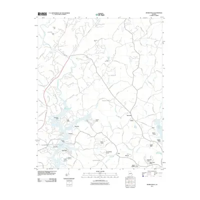
2011 Map of Murrayville
USGS Topo · Published 2011About this map
Calhoun Gold Mine and Turkey Hill Mine stand as prominent reminders of the region's mining heritage, situated in the hilly terrain north of the Chestatee River. By the early twenty-first century, this landscape in Lumpkin County reflects a transition from extraction to recreation and residential growth. The sprawling reach of Lake Sidney Lanier dominates the southern half of the map, with fingers of the reservoir reaching up to Wilkie Bridge and the Toto Creek Access Point.
Find a feature on this map
110 named features on this map. Tap any name to fly to it.
Don’t see what you’re looking for? This feature index may not catch every label — zoom into the map to look around manually.
Map Details
Editions of this 2011 Murrayville Map
This is the sole edition of this map. No revisions or reprints were ever made.
Other maps of this area

1886 · Dahlonega
USGS Topo · 1:125,000

1888 · Ellijay
USGS Topo · 1:125,000

1890 · Suwanee
USGS Topo · 1:125,000

1891 · Gainesville
USGS Topo · 1:125,000

1892 · Dahlonega
USGS Topo · 1:125,000

1892 · Ellijay
USGS Topo · 1:125,000

1894 · Suwanee
USGS Topo · 1:125,000

1896 · Dahlonega
USGS Topo · 1:125,000

1898 · Ellijay
USGS Topo · 1:125,000

1903 · Dahlonega
USGS Topo · 1:125,000