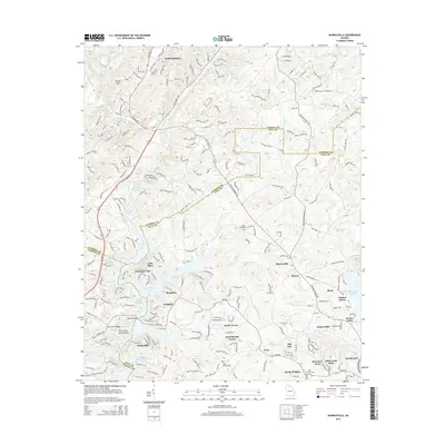
2014 Map of Murrayville
USGS Topo · Published 2014About this map
Lake Sidney Lanier dominates the southern landscape of this 2014 survey, where the rising waters of the reservoir create a complex shoreline of inlets and coves. The map captures the intersection of Lumpkin, Hall, and Dawson counties, showcasing the varied terrain of the Georgia Piedmont. The northern edge of the sheet includes the outskirts of Dahlonega, a historic gold mining center, while the south is marked by numerous residential developments and named points like Lake Shore, Mountain View, and Timberidge. Local heritage is preserved in the location of several community landmarks, including the Yellow Creek Cem and Mount Olive Church. To the east, the rural character persists around Murrayville and Marlow, with a network of secondary roads such as Old Dahlonega Hwy and Claude Parks Rd connecting isolated settlements and family-named landmarks like Bark Camp Place.
Find a feature on this map
236 named features on this map. Tap any name to fly to it.
Don’t see what you’re looking for? This feature index may not catch every label — zoom into the map to look around manually.
Map Details
Editions of this 2014 Murrayville Map
This is the sole edition of this map. No revisions or reprints were ever made.
Other maps of this area

1886 · Dahlonega
USGS Topo · 1:125,000

1888 · Ellijay
USGS Topo · 1:125,000

1890 · Suwanee
USGS Topo · 1:125,000

1891 · Gainesville
USGS Topo · 1:125,000

1892 · Dahlonega
USGS Topo · 1:125,000

1892 · Ellijay
USGS Topo · 1:125,000

1894 · Suwanee
USGS Topo · 1:125,000

1896 · Dahlonega
USGS Topo · 1:125,000

1898 · Ellijay
USGS Topo · 1:125,000

1903 · Dahlonega
USGS Topo · 1:125,000