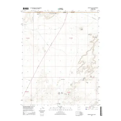
2014 Map of Mystery Valley
USGS Topo · Published 2014About this map
Oljato-Monument Valley anchors the northern portion of this landscape, situated along the border of Utah and Arizona. The area is defined by massive sandstone formations and named erosional features that speak to the indigenous and archaeological history of the region. Distinctive landmarks such as Mitchell Butte and Mitchell Mesa rise above the high desert floor, while the southern reaches of the map transition into the eponymous Mystery Valley. This region is particularly dense with natural formations, including The Spectacles and Full Moon Arch. To the south, a network of canyons and mesas contains numerous named arches like Square House Natural Arch, Eye of the Rabbit, and Stout Arch. The map detail traces the course of Us-163 and Tseya Neechee Canyon, illustrating the relationship between the modern roadway and the complex, ancient topography of the Navajo Nation.
Find a feature on this map
30 named features on this map. Tap any name to fly to it.
Don’t see what you’re looking for? This feature index may not catch every label — zoom into the map to look around manually.
Map Details
Editions of this 2014 Mystery Valley Map
This is the sole edition of this map. No revisions or reprints were ever made.
Other maps of this area

1883 · Marsh Pass
USGS Topo · 1:250,000

1886 · Henry Mountains
USGS Topo · 1:250,000

1892 · Marsh Pass
USGS Topo · 1:250,000

1892 · Henry Mountains
USGS Topo · 1:250,000

1952 · Clay Hills 4 SW
USGS Topo · 1:24,000

1952 · Clay Hills 3 SE
USGS Topo · 1:24,000

1952 · Agathla Peak 1 NW
USGS Topo · 1:24,000

1952 · Boot Mesa
USGS Topo · 1:62,500

1952 · Clay Hills 4 SE
USGS Topo · 1:24,000

1952 · Agathla Peak 1 NE
USGS Topo · 1:24,000