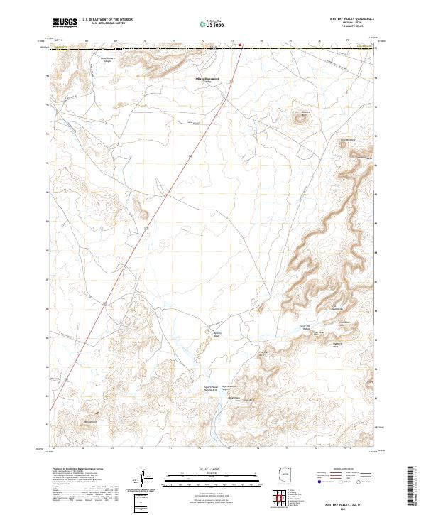
2021 Map of Mystery Valley
USGS Topo · Published 2021About this map
The high desert landscape of Oljato-Monument Valley straddles the Arizona-Utah border, defined by the towering sandstone formations of the Navajo Nation. The intricate erosional patterns of Mystery Valley reveal a high concentration of named natural arches, including Square House Natural Arch, Honeymoon Arch, and the distinctive Eye of the Rabbit. To the east, the terrain rises sharply toward Wetherill Mesa and the prominent Mitchell Mesa. Transport through this arid corridor follows long-established routes like Monument Valley Tribal Park Rd and Indian Rte 6430, which navigate around iconic landmarks such as Mitchell Butte and The Spectacles. This survey documents the modern topography of a region where geological landmarks and Navajo tribal routes shape the primary human footprint.
Find a feature on this map
32 named features on this map. Tap any name to fly to it.
Don’t see what you’re looking for? This feature index may not catch every label — zoom into the map to look around manually.
Map Details
Editions of this 2021 Mystery Valley Map
This is the sole edition of this map. No revisions or reprints were ever made.
Other maps of this area

1883 · Marsh Pass
USGS Topo · 1:250,000

1886 · Henry Mountains
USGS Topo · 1:250,000

1892 · Marsh Pass
USGS Topo · 1:250,000

1892 · Henry Mountains
USGS Topo · 1:250,000

1952 · Clay Hills 4 SW
USGS Topo · 1:24,000

1952 · Clay Hills 3 SE
USGS Topo · 1:24,000

1952 · Agathla Peak 1 NW
USGS Topo · 1:24,000

1952 · Boot Mesa
USGS Topo · 1:62,500

1952 · Clay Hills 4 SE
USGS Topo · 1:24,000

1952 · Agathla Peak 1 NE
USGS Topo · 1:24,000