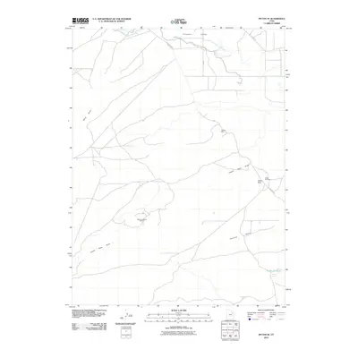
2010 Map of Myton SE
USGS Topo · Published 2010About this map
Pariette Mine and the Castle Peak Mine anchor this high-desert industrial landscape in Duchesne County, capturing the region's long-standing reliance on mineral and resource extraction. The 2010 topography shows a network of remote access routes like Sand Wash Rd and Wells Draw Rd serving the sprawling Monument Butte Oil Field. Water management is central to life in the Pleasant Valley, where the Upper Pleasant Valley Canal and Lower Pleasant Valley Canal cut across the arid terrain to support agriculture and industry. Between the natural elevations of Castle Peak and the flat expanse of Pariette Bench, the map records essential water sources like Snyder Spring and Snyder Reservoir, highlighting the critical infrastructure required for survival and commerce in this corner of the Uinta Basin.
Find a feature on this map
18 named features on this map. Tap any name to fly to it.
Don’t see what you’re looking for? This feature index may not catch every label — zoom into the map to look around manually.
Map Details
Editions of this 2010 Myton SE Map
This is the sole edition of this map. No revisions or reprints were ever made.
Other maps of this area

1885 · East Tavaputs
USGS Topo · 1:250,000

1885 · Ashley
USGS Topo · 1:250,000

1885 · Uinta
USGS Topo · 1:250,000

1886 · Price River
USGS Topo · 1:250,000

1896 · Price River
USGS Topo · 1:250,000

1917 · Vernal
USGS Topo · 1:125,000

1939 · Duchesne
USGS Topo · 1:125,000

1953 · Nutters Hole
USGS Topo · 1:62,500

1954 · Salt Lake City
USGS Topo · 1:250,000

1954 · Vernal
USGS Topo · 1:250,000