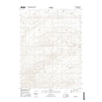
2017 Map of Myton SE
USGS Topo · Published 2017About this map
Pleasant Valley and the surrounding high desert terrain define this corner of the Uinta Basin, where water management is central to the landscape. In the northern reaches, the Upper Pleasant Valley Canal and Lower Pleasant Valley Canal represent the vital irrigation infrastructure necessary for sustaining agriculture and ranching in this arid region. The topographical character is marked by significant features like Pariette Bench and the prominent height of Castle Peak, which serves as a major landmark. Toward the southeast, the presence of Snyder Reservoir and Snyder Spring highlights localized water sources in a landscape otherwise dominated by extensive drainage systems such as Wells Draw and Castle Peak Draw. This survey illustrates the intersections of natural landforms and human-made water diversions in Duchesne County.
Find a feature on this map
17 named features on this map. Tap any name to fly to it.
Don’t see what you’re looking for? This feature index may not catch every label — zoom into the map to look around manually.
Map Details
Editions of this 2017 Myton SE Map
This is the sole edition of this map. No revisions or reprints were ever made.
Other maps of this area

1885 · East Tavaputs
USGS Topo · 1:250,000

1885 · Ashley
USGS Topo · 1:250,000

1885 · Uinta
USGS Topo · 1:250,000

1886 · Price River
USGS Topo · 1:250,000

1896 · Price River
USGS Topo · 1:250,000

1917 · Vernal
USGS Topo · 1:125,000

1939 · Duchesne
USGS Topo · 1:125,000

1953 · Nutters Hole
USGS Topo · 1:62,500

1954 · Salt Lake City
USGS Topo · 1:250,000

1954 · Vernal
USGS Topo · 1:250,000