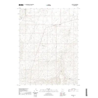
2020 Map of Myton SW
USGS Topo · Published 2020About this map
Antelope Canyon and its associated watercourse, Antelope Cr, carve through the northwestern corner of this high-desert landscape in Duchesne County. This area is defined by a series of significant topographic depressions and dry washes including Pleasant Valley, Gilsonite Draw, and Castle Peak Draw. The names reflect the region's geological and mineral heritage, particularly the presence of Gilsonite, a unique solid hydrocarbon found in this part of Utah. Transportation through this complex terrain relies on a network of back-country routes such as Sowers Canyon Rd and Nine Mile Canyon Rd. The southern portion of the map features several bench roads like Broken Bench Rd and Pariette Bench Rd, indicating a landscape of flat-topped mesas and deep-cut drainage systems like Wells Draw.
Find a feature on this map
14 named features on this map. Tap any name to fly to it.
Don’t see what you’re looking for? This feature index may not catch every label — zoom into the map to look around manually.
Map Details
Editions of this 2020 Myton SW Map
This is the sole edition of this map. No revisions or reprints were ever made.
Other maps of this area

1885 · Uinta
USGS Topo · 1:250,000

1886 · Price River
USGS Topo · 1:250,000

1896 · Price River
USGS Topo · 1:250,000

1939 · Duchesne
USGS Topo · 1:125,000

1954 · Salt Lake City
USGS Topo · 1:250,000

1956 · Price
USGS Topo · 1:250,000

1958 · Salt Lake City
USGS Topo · 1:250,000

1960 · Salt Lake City
USGS Topo · 1:250,000

1960 · Price
USGS Topo · 1:250,000

1962 · Price
USGS Topo · 1:250,000