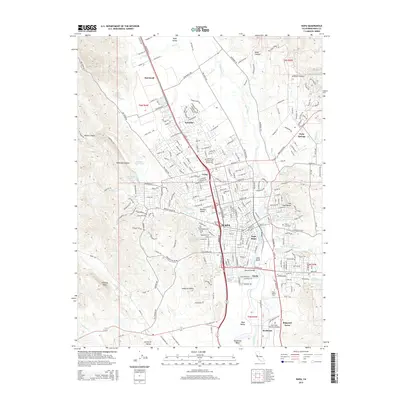
2015 Map of Napa
USGS Topo · Published 2015About this map
Napa centers this 2015 survey, showing the city's modern layout along the Napa River as it winds toward Jacks Bend and Horseshoe Bend. The map illustrates the surrounding valley floor and its transition into the high ridges of the Howell Mountains and Mayacamas Range. Long-established neighborhoods and industrial points like Napa Abajo, Imola, and Rocktram sit near the river corridor, while the north is defined by the agricultural and residential patterns of Oak Knoll and Salvador. Local history is preserved in the location of Tulocay Cemetery and the Napa Valley Memorial Gardens. Higher elevations to the west and east are marked by prominent geographic features such as Milliken Peak and the curiously named Cup and Saucer hill, providing a clear picture of the topography that has shaped this famous viticultural region.
Find a feature on this map
251 named features on this map. Tap any name to fly to it.
Don’t see what you’re looking for? This feature index may not catch every label — zoom into the map to look around manually.
Map Details
Editions of this 2015 Napa Map
This is the sole edition of this map. No revisions or reprints were ever made.
Other maps of this area

1896 · Carquinez Strait
USGS Topo · 1:62,500

1898 · Karquines
USGS Topo · 1:62,500

1901 · Karquines
USGS Topo · 1:62,500

1902 · Napa
USGS Topo · 1:125,000

1916 · Mare Island
USGS Topo · 1:62,500

1921 · Mt. Vaca
USGS Topo · 1:62,500

1940 · Carquinez Strait
USGS Topo · 1:62,500

1942 · Mare Island
USGS Topo · 1:62,500

1942 · Carquinez
USGS Topo · 1:62,500

1942 · Sonoma
USGS Topo · 1:62,500