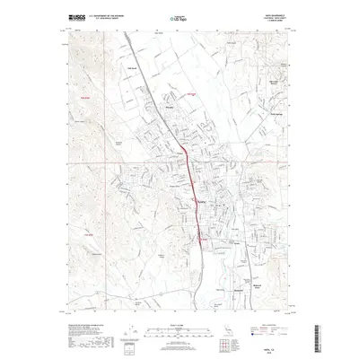
2018 Map of Napa
USGS Topo · Published 2018About this map
The Napa River forms the central artery of this Napa County landscape, winding past the urban core of Napa and through the fertile expanse of Napa Valley. This 2018 survey documents the dense residential development and established estates that define the region, from the suburban layouts of Salvador and Union to the specialized enclaves at Silverado Resort and Vichy Springs. The geography transitions from the flat valley floor to the prominent rising heights of Milliken Peak and the western slopes of Redwood Canyon, while the eastern side is marked by distinctive formations like the Cup and Saucer. Institutional and commemorative sites are prominent, including Napa Valley College and the extensive grounds of the Tulocay Cem, providing significant touchstones for local history and genealogy. Infrastructure such as the Silverado Trail and Solano Ave connects the outlying areas of Oak Knoll and Carneros Valley to the city center.
Find a feature on this map
157 named features on this map. Tap any name to fly to it.
Don’t see what you’re looking for? This feature index may not catch every label — zoom into the map to look around manually.
Map Details
Editions of this 2018 Napa Map
This is the sole edition of this map. No revisions or reprints were ever made.
Other maps of this area

1896 · Carquinez Strait
USGS Topo · 1:62,500

1898 · Karquines
USGS Topo · 1:62,500

1901 · Karquines
USGS Topo · 1:62,500

1902 · Napa
USGS Topo · 1:125,000

1916 · Mare Island
USGS Topo · 1:62,500

1921 · Mt. Vaca
USGS Topo · 1:62,500

1940 · Carquinez Strait
USGS Topo · 1:62,500

1942 · Mare Island
USGS Topo · 1:62,500

1942 · Carquinez
USGS Topo · 1:62,500

1942 · Sonoma
USGS Topo · 1:62,500