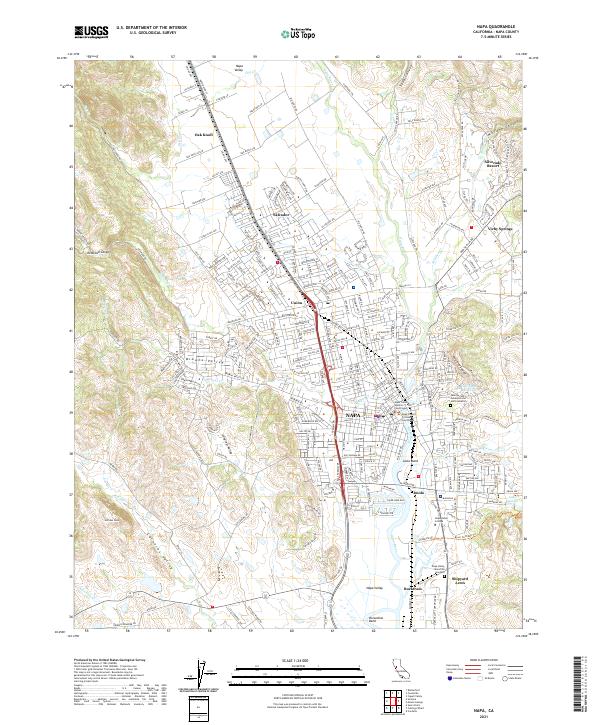
2021 Map of Napa
USGS Topo · Published 2021About this map
Napa Valley opens into a landscape of transitioning agriculture and growing suburban centers in this 2021 study. The Napa River serves as the central artery, winding past the commercial and residential core of Napa and the grounds of the Napa State Hospital. The map detail reveals the distribution of historic settlement points like Union, Salvador, and Oak Knoll as they have been integrated into the modern road network defined by State Hwy 29. To the east, the terrain rises toward Mount George, with the Skyline Wilderness Park preserving significant open space. This survey effectively documents the intersection of local history and modern development, from the quiet expanses of Tulocay Cem to the educational campus of Napa Valley College, providing a clear view of the region's current layout alongside its deep-rooted place names.
Find a feature on this map
38 named features on this map. Tap any name to fly to it.
Don’t see what you’re looking for? This feature index may not catch every label — zoom into the map to look around manually.
Map Details
Editions of this 2021 Napa Map
This is the sole edition of this map. No revisions or reprints were ever made.
Historical Maps of Vichy Springs Through Time
4 maps found