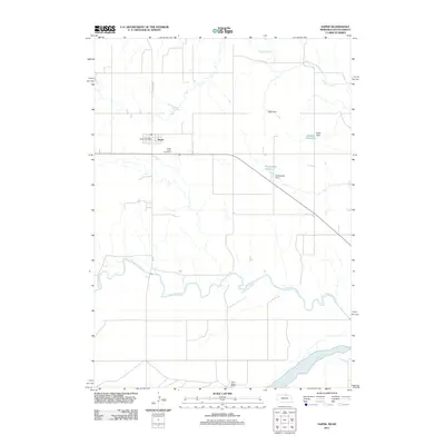
2011 Map of Naper
USGS Topo · Published 2011About this map
Naper sits at the northern edge of Boyd County, serving as a primary hub of settlement in this prairie landscape defined by the winding paths of the Keya Paha River and the Niobrara River to the south. Local heritage is centered around the village core, where the Naper Post Office and the Knoll Crest Cemetery anchor the community's geographic history. The landscape is marked by a series of water management features, including the Stoltenberg Reservoir and Keller Reservoir, which illustrate the necessity of irrigation and livestock watering in this rural environment. To the southeast, the White Horse Ranch represents the agricultural heritage of the region. The map also traces the drainage of Ponca Creek in the north, providing a clear picture of the hydrological network that dictates the placement of roads like State Spur 8a and various local routes.
Find a feature on this map
14 named features on this map. Tap any name to fly to it.
Don’t see what you’re looking for? This feature index may not catch every label — zoom into the map to look around manually.
Map Details
Editions of this 2011 Naper Map
This is the sole edition of this map. No revisions or reprints were ever made.
Other maps of this area

1951 · Butte NW
USGS Topo · 1:24,000

1951 · Naper
USGS Topo · 1:24,000

1951 · Butte SW
USGS Topo · 1:24,000

1951 · Dustin
USGS Topo · 1:24,000

1951 · Naper SW
USGS Topo · 1:24,000

1955 · Mitchell
USGS Topo · 1:250,000

1955 · O'Neill
USGS Topo · 1:250,000

1959 · O'Neill
USGS Topo · 1:250,000

1959 · Mitchell
USGS Topo · 1:250,000

1964 · St. Charles
USGS Topo · 1:24,000