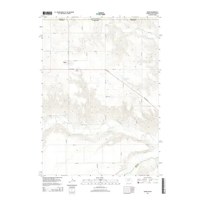
2014 Map of Naper
USGS Topo · Published 2014About this map
Naper sits near the Nebraska-South Dakota border in this 2014 survey, serving as a focal point for the surrounding agricultural landscape of Boyd County. The settlement is positioned just north of State Highway 12, which cuts a diagonal path across the terrain. To the south, the Keya Paha River meanders through a network of drainage basins, while Ponca Cr flows through the northern reaches near the state line. Several water management features, including Blum Reservoir, Keller Reservoir, and Stoltenberg Reservoir, are distributed across the township, reflecting the area's reliance on water conservation. Local history and genealogy interest is anchored by Knoll Crest Cem, located just outside the main village. The map detail illustrates the precise section-line road system, featuring named routes such as Emerald Rd and Franklin Rd, which define the local transport network.
Find a feature on this map
22 named features on this map. Tap any name to fly to it.
Don’t see what you’re looking for? This feature index may not catch every label — zoom into the map to look around manually.
Map Details
Editions of this 2014 Naper Map
This is the sole edition of this map. No revisions or reprints were ever made.
Other maps of this area

1951 · Butte NW
USGS Topo · 1:24,000

1951 · Naper
USGS Topo · 1:24,000

1951 · Butte SW
USGS Topo · 1:24,000

1951 · Dustin
USGS Topo · 1:24,000

1951 · Naper SW
USGS Topo · 1:24,000

1955 · Mitchell
USGS Topo · 1:250,000

1955 · O'Neill
USGS Topo · 1:250,000

1959 · O'Neill
USGS Topo · 1:250,000

1959 · Mitchell
USGS Topo · 1:250,000

1964 · St. Charles
USGS Topo · 1:24,000