2021 Map of Naper
USGS Topo · Published 2021About this map
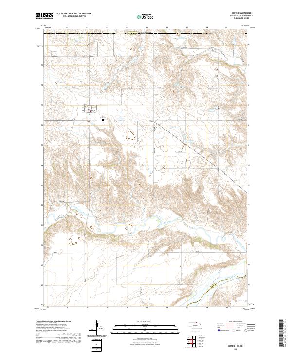
Naper stands as a focal point in Boyd County near the South Dakota border, positioned along a network of section-line roads such as 906 Rd and 4th St. This area of northern Nebraska is defined by its dramatic drainage patterns, where the land drops away from the plateau into the winding valleys of the Keya Paha River and the Niobrara River to the south. Local water management is evident through several named impoundments like Blum Reservoir and Stoltenberg Reservoir, which dot the landscape between the river forks. For those researching the community's history, the map identifies the Knoll Crest Cemetery just south of town and the central Post Office, providing clear anchors for local genealogy and settlement study in this rural corridor.
Find a feature on this map
29 named features on this map. Tap any name to fly to it.
Don’t see what you’re looking for? This feature index may not catch every label — zoom into the map to look around manually.
Map Details
Editions of this 2021 Naper Map
This is the sole edition of this map. No revisions or reprints were ever made.