
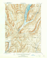
1900 Map of Naples
USGS Topo · Published 1956About this map
Canandaigua Lake dominates the northern reaches of this region, its shoreline dotted with landings like Hicks Point and Miller Landing that once served the busy steamboat routes. The landscape is defined by deep glacial valleys and high points such as Gannett Hill and Bare Hill, which hem in the village of Naples. At the turn of the century, the local economy relied heavily on a dense network of railroads to transport agricultural goods from the hills. The Pennsylvania R.R. (Naples Branch) terminates in the heart of Naples, while the Kanona and Prattsburg R.R. connects the southern reaches through Prattsburg. In the east, the Lehigh Valley line skirts the edge of Middlesex. This survey captures a rural landscape where small communities like Italy Hill and South Bristol were connected by hollow roads, such as West Hollow and Italy Hollow, before modern highways altered the valley floors.
Find a feature on this map
85 named features on this map. Tap any name to fly to it.
Don’t see what you’re looking for? This feature index may not catch every label — zoom into the map to look around manually.
Map Details
Editions of this 1900 Naples Map
2 editions found
Other maps of this area

1900 · Canandaigua
USGS Topo · 1:62,500

1901 · Honeoye
USGS Topo · 1:62,500

1902 · Phelps
USGS Topo · 1:62,500

1902 · Wayland
USGS Topo · 1:62,500

1903 · Naples
USGS Topo · 1:62,500

1903 · Canandaigua
USGS Topo · 1:62,500

1903 · Penn Yan
USGS Topo · 1:62,500

1903 · Hammondsport
USGS Topo · 1:62,500

1904 · Wayland
USGS Topo · 1:62,500

1904 · Honeoye
USGS Topo · 1:62,500