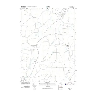
2010 Map of Naples
USGS Topo · Published 2010About this map
Naples sits at the northern edge of this high-relief landscape where the waters of Grimes Creek and Eelpot Creek descend through narrow valleys toward the larger Naples Creek. The 2010 geography reveals a pattern of ridge-top agriculture and valley-floor settlements connected by a web of rural roads like Lent Hill Rd and Garlinghouse Atlanta Rd. To the south, the Cohocton River begins its course near the village of Cohocton, while small hamlets such as Atlanta, Kirkwood, and Lent Hill dot the southern uplands. For genealogists and local historians, the map is remarkably dense with burial grounds, ranging from larger sites like Rose Ridge Cemetery near the village center to more isolated locations including Gerould Cemetery, Wheaton Cemetery, and the Flint Hill Cemetery. Significant terrain features like Hatch Hill, Knapp Hill, and the deep drainage of Lyon Hollow define the region's character.
Find a feature on this map
85 named features on this map. Tap any name to fly to it.
Don’t see what you’re looking for? This feature index may not catch every label — zoom into the map to look around manually.
Map Details
Editions of this 2010 Naples Map
This is the sole edition of this map. No revisions or reprints were ever made.
Other maps of this area

1900 · Naples
USGS Topo · 1:62,500

1902 · Wayland
USGS Topo · 1:62,500

1903 · Naples
USGS Topo · 1:62,500

1904 · Wayland
USGS Topo · 1:62,500

1910 · Bath
USGS Topo · 1:62,500

1913 · Naples
USGS Topo · 1:62,500

1915 · Hornell
USGS Topo · 1:62,500

1918 · Hornell
USGS Topo · 1:62,500

1942 · Springwater
USGS Topo · 1:31,680

1942 · Wayland
USGS Topo · 1:31,680