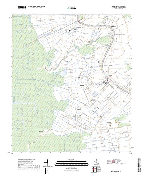
2024 Map of Napoleonville
USGS Topo · Published 2024About this map
Bayou Lafourche serves as the primary artery for settlement through this section of Assumption Parish, with a dense corridor of hamlets and cemeteries lining its banks. The Assumption Parish Courthouse stands as the civic heart of Napoleonville, surrounded by historic religious sites including Christ Episcopal Cem and Saint Anne Cem. This landscape is defined by the transition from riverfront commerce to intensive plantation agriculture, evidenced by the extensive network of drainage and transport canals like Godechaux Canal and Attakapas Canal that reach into the surrounding wetlands.
Find a feature on this map
134 named features on this map. Tap any name to fly to it.
Don’t see what you’re looking for? This feature index may not catch every label — zoom into the map to look around manually.
Map Details
Editions of this 2024 Napoleonville Map
This is the sole edition of this map. No revisions or reprints were ever made.
Other maps of this area

1892 · Donaldsonville
USGS Topo · 1:62,500

1892 · Thibodaux
USGS Topo · 1:62,500

1927 · Thibodaux NW
USGS Topo · 1:31,680

1932 · Thibodaux SW
USGS Topo · 1:31,680

1936 · White Castle
USGS Topo · 1:62,500

1938 · Labadieville
USGS Topo · 1:24,000

1939 · Donaldsonville
USGS Topo · 1:62,500

1940 · Madewood
USGS Topo · 1:31,680

1945 · New Orleans
USGS Topo · 1:250,000

1947 · Donaldsonville
USGS Topo · 1:31,680